Falling Temperatures For The Weekend . . . .
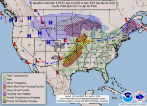
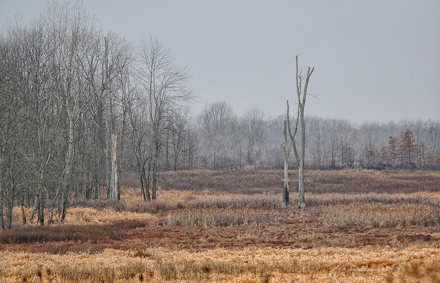
Our fickle weather continues. We had thunderstorms overnight which left a little over half and inch in my gauge. Temperatures were in the 60s all night, then started dropping this morning. At least we aren’t getting snow or freezing rain. Sunday is Easter, and it will feel like anything but spring. Highs are expected to only reach the 40s but we’re going to cook out anyway.
Our 2:30 PM temperature is 53°F, the humidity is 74% and winds are from the west at 7-11 mph. Skies are overcast and the pressure is 30.01 in and rising. The dew point is 41°F and visibility is 10 miles. Yesterday’s high was 60°F and the overnight low was 52°F. Record temps for April 2 are 79°F (2010) and 17°F (2018). Sunrise was t 7:15 AM and sunset will be at 8:04 PM.
DURAND / OWOSSO FORECAST:
This Afternoon: Mostly cloudy. Highs in the mid 50s. Winds WNW at 10-20 mph with higher gusts possible.
Tonight: A chance of showers and thunderstorms. Lows in the upper 30s. Winds NE at 10-15 mph. Chance of rain 80%.
Saturday: Cloudy with rain and a possible thunderstorm. Highs in the mid 60s. Winds SW at 15-20 mph gusting higher at times. Chance of rain 100%.