Air Quality Alert And Unreasonably Hot Temperatures . . . . .
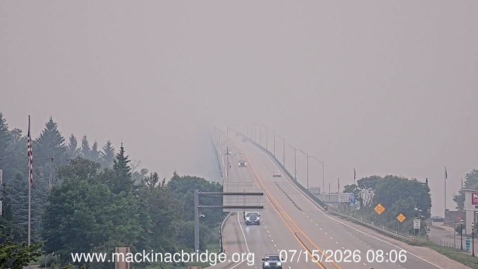
Today will not be a good day to be outdoors. Not only because it is hot, but we are under attack from Canadian wildfires once again. It seems like this is becoming an annual event. My picture was taken at the Mackinaw Bridge this morning, and the smoke is so thick that the towers on the bridge aren’t even visible. Most hasn’t reached us yet, but the air quality alert goes into effect at 3 PM. Yesterday reached 100F for the first time in years. Although our official high was 99°F, the heat index rose to 104°F. Today will be about 10 degrees cooler, but that’s still too hot for my liking.
Our 1 PM temperature is 91°F, the humidity is 50%, and skies are mostly clear. Winds are from the west at 0-5 mph, and the pressure is 29.89 in and falling. The dew point is 71°F and visibility is 10 miles. Yesterday’s high was 99°F and the overnight low was 73F. Average temps for this date are 82°F/60°F. Record temps for July 14 are 99°F (yesterday) and 48°F (2009). Sunrise was at 6:11 AM and sunset will be at 9:14 PM.
DURAND / OWOSSO FORECAST:
Today: A mix of sun and clouds, with dangerous high temps, haze and smoke. A slight chance of a thunderstorm developing. Highs in the low 90s. Winds NW at 5-10 mph.
Tonight: Partly cloudy skies. Widespread areas of smoke. Lows in the mid 60s. Winds north at 5-10 mph.
Thursday: Partly sunny. Highs in the low 90s. Widespread smoke early. Winds NNW at 5-10 mph.