
Severe Thunderstorm Watch . . . . .
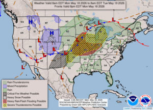
We have a line of storms approaching from the southwest and some could be destructive. They are saying that the chance for tornadoes is low but high winds and hail can be just as bad. I’m anticipating that they will arrive in our area around 4 or 5 PM.
Our 2:30 PM temperature is 87°F, the humidity is 47%, and skies are mostly cloudy. Winds are from the SSW at 6-19 mph and the pressure is 30.12 in and falling. Visibility is 11 mph and the dew point is 60°F. Yesterday’s high was 84°F and the overnight low was 56°F. Record temps for May 17 are 84°F (tying the record from 2017) and 34°F (2023). Sunrise was at 6:11 AM and sunset will be at 8:56 PM.
DURAND/OWOSSO FORECAST:
This Afternoon: Severe thunderstorm watch until 8 PM. Possible thunderstorms after 4 PM. Highs in the upper 80s. Winds SW at 20-30 mph. Chance of rain 80%.
Tonight: Continued thunderstorms possible. Lows in the upper 60s. Winds SSW at 10-15 mph. Chance of precip 60%.
Tuesday: Partly sunny with possible thunderstorms. Some could be severe. Winds SW at 15-25 mph.