
Could Have More Severe Weather . . . .

Our morning has cloudy skies with some sun shining through. There is another chance for severe weather this afternoon, but mainly for the southeastern parts of the state. There is another cold front knocking on our door, and a significant cool-down will happen early next week. Today will be hot and humid, and hopefully, this will be the end of this high-temp weather. I’m ready for fall.
Our 9:45 PM temperature is 77°F (25°C), the humidity is 84%, and skies are cloudy. The pressure is 29.95 in (1014.2 mb) and falling. Winds are from the south at 4-8 mph, and the dew point is 70°F (21°C). Visibility is 11 miles. Yesterday’s high was 80F and the overnight low is 64°F (18°C). Average temps for this date are 78°F/56°F. Record temps for August 29 are 96°F (1973), and 26°F (1863). Sunrise was at 7:00 AM, and sunset will be at 8:16 PM.
DURAND / OWOSSO FORECAST:
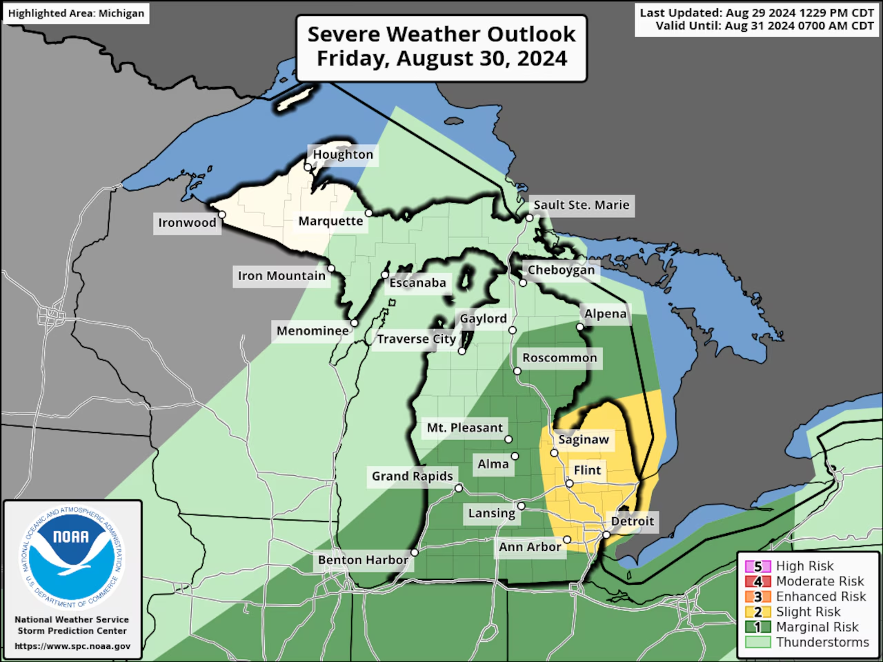
Today: Mostly cloudy early, then scattered showers and thunderstorms in the afternoon. Some could be severe. High 87°F (31°C). Winds SW at 5-10 mph, gusting higher in thunderstorms. Chance of rain 40%.
Tonight: Showers and thunderstorms likely early. Low 62°F (17°C). Winds WNW at 5-10 mph. Chance of rain 40%.
Saturday: Mostly sunny. High 82°F (28°C). Winds W at 5-10 mph.
