
Significant Storms Expected Today . . . .
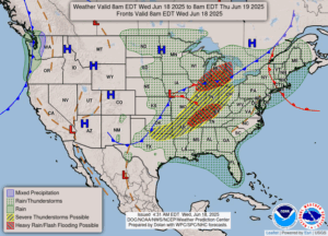
A round of severe storms is likely later today. Radar now is showing small cells developing in various parts of the state. We just had a quick shower and I’m sure there’s a lot more coming. It is significantly cooler today, and that makes me very happy since our AC went out yesterday. The repair man can’t come until this afternoon. So it won’t be too bad.
Our 10 AM temperature is 71°F, the humidity is 91%, and skies are overcast. Winds are from the N at 3-6 mph. and the pressure is 29.80 in and rising. The dew point is 68°F and visibility is 6 miles. Yesterday’s high was 89°F and the overnight low was 69°F. Average temps for this date are 77°F/57°F. Record temps for June 27 are 97°F (1021) and 41°F (1958). Sunrise was at 5:57 AM and sunset will be at 9:18 PM.
DURAND / OWOSSO FORECAST:
Today: Showers and thunderstorms in the afternoon. Some could be severe. Highs in the low 80s. Winds SSW at 5-10 mph. Chance of rain 70%.
Tonight: Continued showers and thunderstorms, some producing heavy rainfall. Lows in the low 60s. Winds WNW at 10-15 mph. Chance of precip 80%.
Tomorrow: Showers ending in the morning, then mostly cloudy in the afternoon. Highs in the upper 70s. Winds NW at 10-15 mph. Chance of precip 30%.
