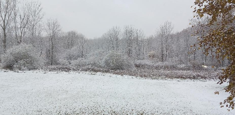
Our First Snowfall . . . .
Snow began falling overnight and left an inch of snow cover by 8 AM. Light snow has continued to fall since then and the wet snow is clinging to everything. It’s a very pretty scene. Temperatures won’t make it our of the 30s today and we could get another inch by the time it is finished.
Our 10:30 AM temp is 33°F, the humidity is 94%, and skies are cloudy with light snow. Winds are from the north at 2-5 mph, and the pressure is 29’93 in and steady. The dew point is 32°F and visibility is 2 miles. Yesterday’s high was 46°F and the overnight low was 32°F. Average temps for this date are 50°F/35°F. Record temps for Nov. 9 are 74°F (2020) and 19°F (2019). Sunrise was at 7:22 AM and sunset will be at 5:20 PM.
DURAND / OWOSSO FORECAST:
Today: Light to moderate snow. Highs in the mid 30s. Winds 10-15 mph, gusting higher at times. Chance of snow 80%.
Tonight: Cloudy with continued snow showers. Lows in the lower 20s. Winds 10-20 mph. Chance of snow 60%.
Monday: Mostly cloudy with snow flurries possible. Highs in the mid 30s. Winds NNW at 10-15 mph, gusting higher at times. Chance of snow 30%.