
A Dark, Dreary Day Ahead Of Another Strong Cold Front . . . . .
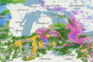
Today will be on the mild side, ahead of a strong cold air mass which will affect our weather for the next week. Tomorrow will be the worst with very strong sustained winds and gusts as high as 60 mph. Today will be rainy with the possibilities of some thunder. In fact, we heard a little thunder yesterday with the rain, but it was off in the distance. Some storm chasers reported hail between Owosso and Chesaning. We received almost half an inch of rain yesterday and overnight.
Our 2 PM temperature is 38°F, the humidity is 97%, and skies are overcast with light rain. Winds are from the east at 0-4 mph. The pressure is 29.36 in and falling. The dew point is 37°F and visibility is 4 miles. Yesterday’s high was 34°F and the overnight low was 31°F. Average temps for this date are 32°F/21°F. Record temps for Dec. 27 are 62°F (2019) and -7°F (2017). Sunrise was at 8:07 AM and sunset will be at 5:09 PM.,
DURAND / OWOSSO FORECAST:
This Afternoon: Cloudy with steady rain and possibly a thunderstorm. Rain could be heavy at times. Winds SE at 5-10 mph the chance for precip is 100%,.
Tonight: High wind warning in effect. Increasing winds with scattered thunderstorms. Winds SW at 25-35 mph, with higher gusts possible. Lows in the lower 20s.
Monday: Falling temps with snow showers. Cloudy through the afternoon and highs in the upper 20s. Winds WNW at 25-40 mph, gusting as high as 50 mph, Chance of precip 90% with snow accumulations of 1-3 inches.