Cold, Snowy And A Wind Advisory . . . .
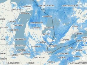
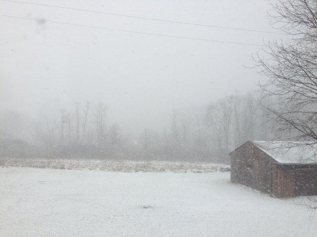
After a lovely 53 degrees yesterday, the cold front moved in late yesterday, dropping the temperatures 15 degrees in about 45 minutes. We had rain all day and some showers were quite heavy. There was 1.49″ in my rain gauge at 8 AM, and snow began shortly after. We now have about an inch on the ground with a lot of blowing, and snow squalls continue. After a high wind warning early today, it has now decreased to a wind advisory. The upper peninsula is basically closed as blizzard conditions continue. People are being warned to not venture out as there would be no help available if they get stranded.
Our 12:45 PM temperature is 25°F, the humidity is 72%, and skies are overcast with a snow shower. Winds are from the west at 20-30 mph, with the highest gust at 41 mph. The pressure is 29.39 in and rising. The dew point is 15°F and visibility is 2 miles. Yesterday’s high was 53°F and the overnight low was 27°F. Average temps for this date are 32°F/21°F. Record temps for Dec. 28 are 62°F (2006) and -16°F (2017). Sunrise was at 8:07 AM and sunset will be at 5:10 PM.
DURAND / OWOSSO FORECAST:
This Afternoon: Very windy with intermittent snow squalls,. Winds WNW at 25-35 mph, gusting into the 40 mph range. Steady temps in the mid 20s. Chance of precip 100%.
Tonight: Scattered snow showers early. Gusty winds continue at 20-30 mph from the WNW. Lows in the upper teens.
Tuesday: Cloudy with snow showers in the afternoon. Highs in the mid 20s. Winds WNW at 15-25 mph. Chance of snow 50%.