Severe Weather In Our Forecast . . . .
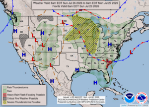
We could be in store for some pretty heavy weather tonight and tomorrow. Michigan Storm Chasers are giving us a 30-40% chance for severe weather tomorrow. They will be giving updates throughout today with the latest information. Right now we have sun and very warm temperatures. Highs could reach near 90°F once again, but the storms should cool it down.
Our 1 PM temperature is 83°F, the humidity is 51%, and winds are from the west at 0-5 mph, and the pressure is 30.08 in and falling. The dew point is 66°F, visibility is 10 miles, and the air quality is moderate at 66. Yesterdays high was 83°F and the overnight low was 68°F. Average temps for this date are 82°F/60°F. Record temps for July 26 are 94°F (2025) and 48°F (2017). Sunrise was at 6:21 AM and sunset will be at 9:05 PM.
DURAND / OWOSSO FORECAST:
This Afternoon: Partly cloudy with highs in the upper 80s. There is a chance for a shower or thunderstorm developing. Winds west at 10-15 mph. Chance of rain 30%.
Tonight: Becoming cloudy overnight. A chance for showers or thunderstorms early. Lows in the upper 60s. Winds SW at 10-15 mph. Chance of rain 30%.
Monday: Partly sunny with storm developing in the afternoon. Some could be severe. Highs in the upper 80s. Winds SW at 10-15 mph. Chance of rain 50%.