The Heat Has Returned . . . .
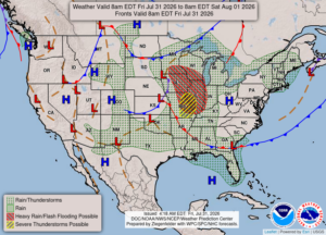
After several cooler days, our temperatures have once again returned to furnace status. We will see highs close to 90°F, but showers will bring relief for the weekend and next week.
Our 11 AM temperature is 81°F, the humidity is 45%, and skies are clear. Winds are light from the west, and the pressure is 30.16 in and falling. The dew point is 57°F and visibility is 10 miles. The air quality index is moderate at 65. Yesterdays high was 89°F and the overnight low was 63°F. Average temps for this date are 81°F/60°F. Record temps for July 30 are 92°F (2015) and 49°F (2013). Sunrise was at 6:27 AM and sunset will be at 8:24 PM.
DURAND / OWOSSO FORECAST:
Today: Early sun with increasing clouds in the afternoon. Highs in the upper 80s. There could be some smoke and haze causing reduced visibility. Winds west at 5-10 mph.
Tonight: Cloudy with showers and thunderstorms possible. Lows in the upper 60s. Winds light and variable. Chance of rain 60%.
Saturday: Overcast skies with occasional showers in the afternoon. Highs in the mid 70s. Winds ENE at 10-15 mph. Chance of rain 70%.