
Stormy Weather Possible . . . .
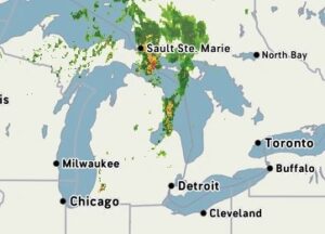
Our day began with sun, but now clouds have arrived with the possibility of heavy thunderstorms this afternoon. Temperatures should remain in the 70s most of the day, so it will be comfortable to be outdoors, and even have the windows open for a change.
Our 1 PM temperature is 77°F, the humidity is 57% and skies are cloudy. Winds are from the SSW at 2-7 mph, and the pressure is 29.91 in and falling. The dew point is 60°F and visibility is 10 miles. Yesterday’s high was 79°F and the overnight low was 58°F. Average temps for this date are 79°F/57°F. Record temps for August 25 are 92°F (2020) and 43°F (2017). Sunrise was at 6:55 AM and sunset will be at 8:23 PM.
DURAND / OWOSSO FORECAST:
Today: Increasing clouds with showers and thunderstorms developing. Gusty winds and hail are possible. Highs near 80°F. Winds SW at 10-15 mph. Chance of rain 80%.
Tonight: Showers and thunderstorms early, then becoming partly cloudy overnight. Lows in the lower 60s. Chance of rain 60%.
Thursday: Mostly sunny with a high near 80°F. Winds WNW at 5-10 mph.