Severe Weather, Much Damage, Power Outages . . . .
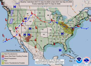
Wednesday and Thursday brought severe weather to our state, but yesterday was worse. Southern Michigan really got slammed especially the Detroit area. My area had a lot of rain but nothing really severe. There is still a slight chance for more today, although radar isn’t showing much, and what there is seems to be sliding to our south. We received just under two inches of rain the past two days, and I think we have enough for a while.
Our 1 PM temperature is 74°F, the humidity is 93%, and winds are from the south at 0-3 mph. The pressure is 29.90 in and steady. The dew point is 71°F and visibility is 10 miles. Yesterday’s high was 91°F and the overnight low was 66°F. Average temps for this date are 77°F/55°F. Sunrise was at 7:05 AM and sunset will be at 8:07 PM.
DURAND / OWOSSO FORECAST:
today: Overcast skies with a chance of showers and a thunderstorm. Highs in the upper 70s. Winds WNW at 5-10 mph. Chance of rain 50%.
Tonight: Cloudy with a stray shower or thundershower possible. Low in the lower 60s. Winds ENE at 0-5 mph. Chance of rain 40%.
Saturday: A mix of sun and clouds. Highs in the upper 70s. Winds Ne at 5-10 mph.